In the past 20 years, the population of Edgewater has increased by 47%. However, this population growth has not made the community more vibrant. On the contrary, the constantly rising demand for housing has led to the demolition of many old buildings, which are replaced by high-rise residential buildings. One of the main challenges with high-rise buildings is that they tend to be more isolated from the surrounding community. This is because they are often physically separated from other buildings and amenities, making it more difficult for residents to interact with their neighbors and the broader community. Additionally, high-rise buildings can create a sense of detachment and anonymity among residents, further eroding a sense of community. This can be exacerbated by using elevators instead of stairwells, reducing incidental interaction between residents.
Another challenge facing Miami is flooding caused by global warming. According to a Southeast Florida Regional Climate Change Compact report, the number of days with flooding in Miami is expected to increase significantly in the coming decades. The report projects that by 2040, Miami could experience up to 33 days of flooding per year, and by 2060, up to 80 days of flooding per year.
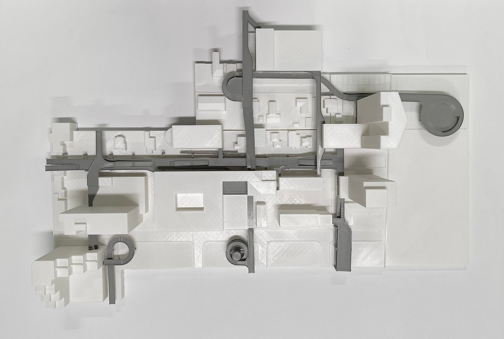
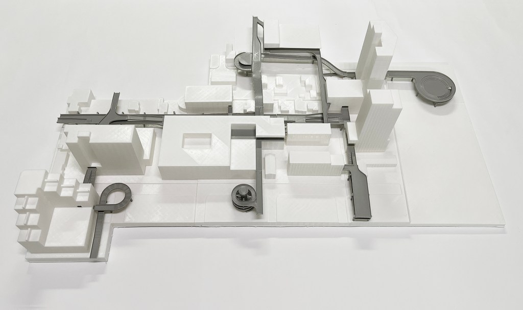
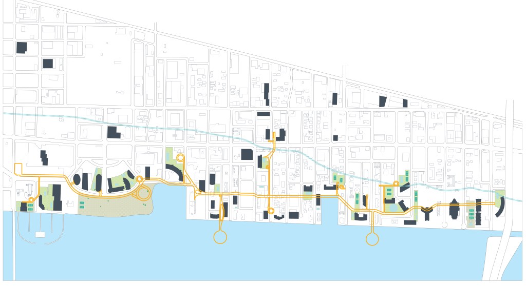
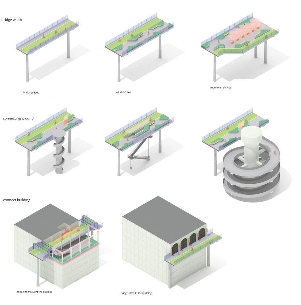
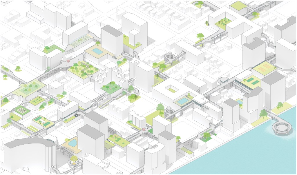
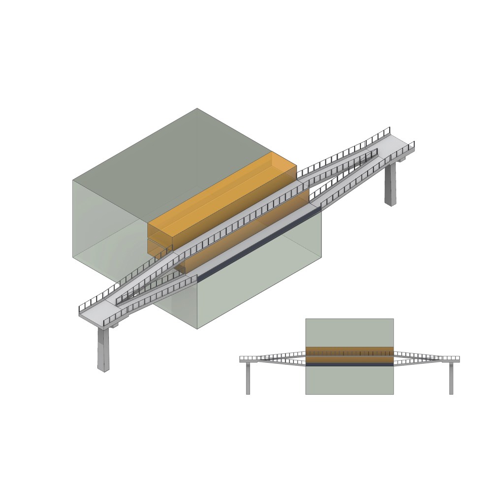
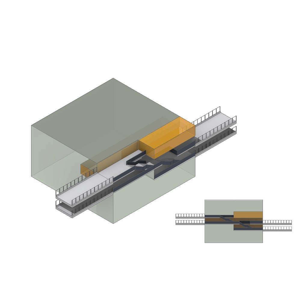
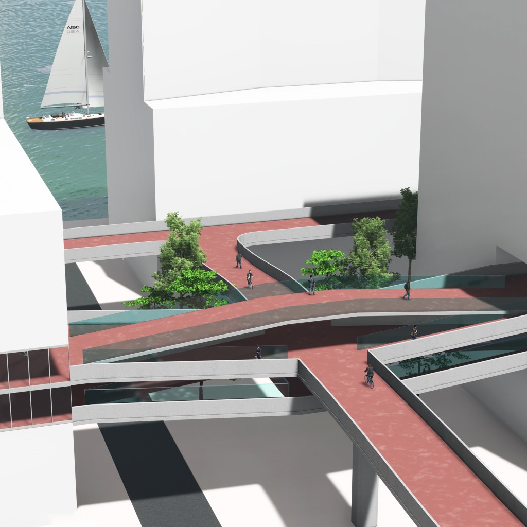
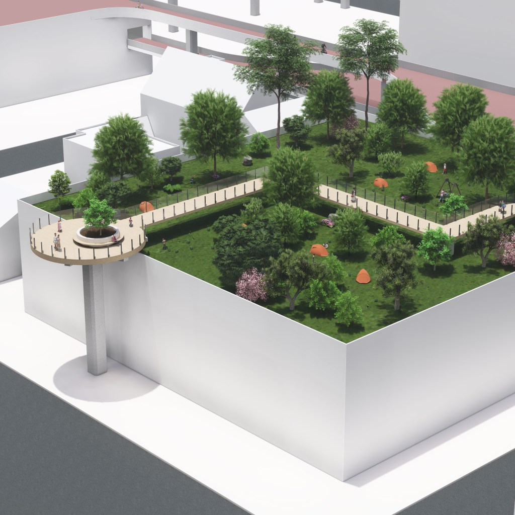
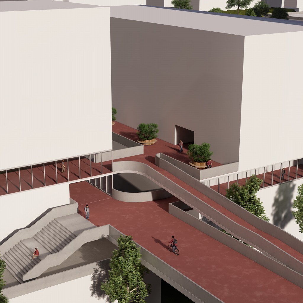
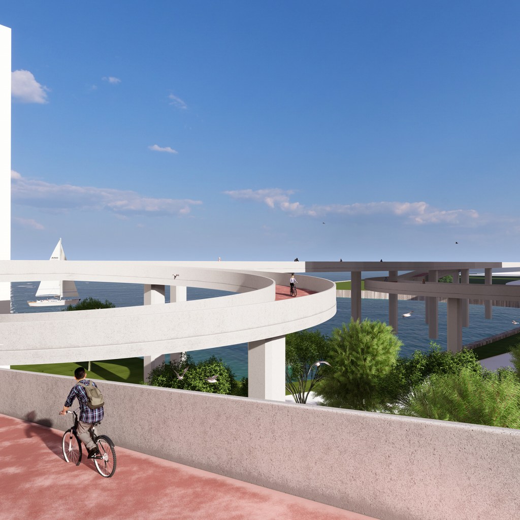
To address these challenges, my proposal is to build a bridge that connects the various high-rise buildings in the area, making it more convenient for residents to live and communicate and enhancing the atmosphere of the community. Depending on the bridge’s width, bike lanes, pedestrian walkways, green belts, and other public facilities can be added. The different ways the bridge connects to the buildings will also impact the interior of the buildings, transforming them from single-function residential buildings into multi-functional spaces. The bridge’s height is about 55 feet from the ground, which can connect existing public facilities located on parking lot rooftops and transform the singularity of the public facilities. Vertical transportation connecting to the ground will be located every 500 feet along the bridge, allowing residents who do not live in high-rise buildings to efficiently use the bridge. The bridge will connect Blue on the Bay and the railway station from north to south, while the east-west branches will connect distant buildings, providing more possibilities for the future extension of the bridge.
Mid – Review
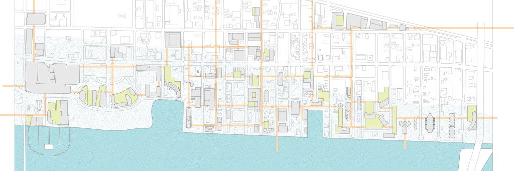
Site Map
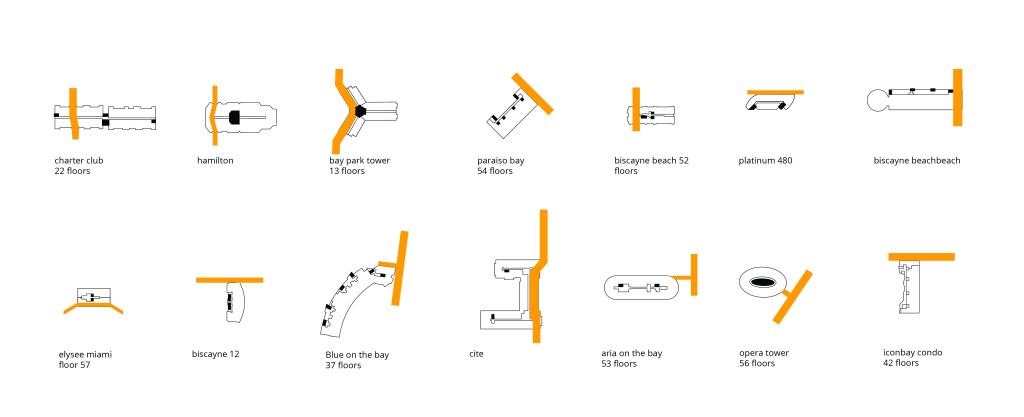
Building Type (How a bridge connects a building)
Bridge Type
Final
Site Map
ISO Drawing
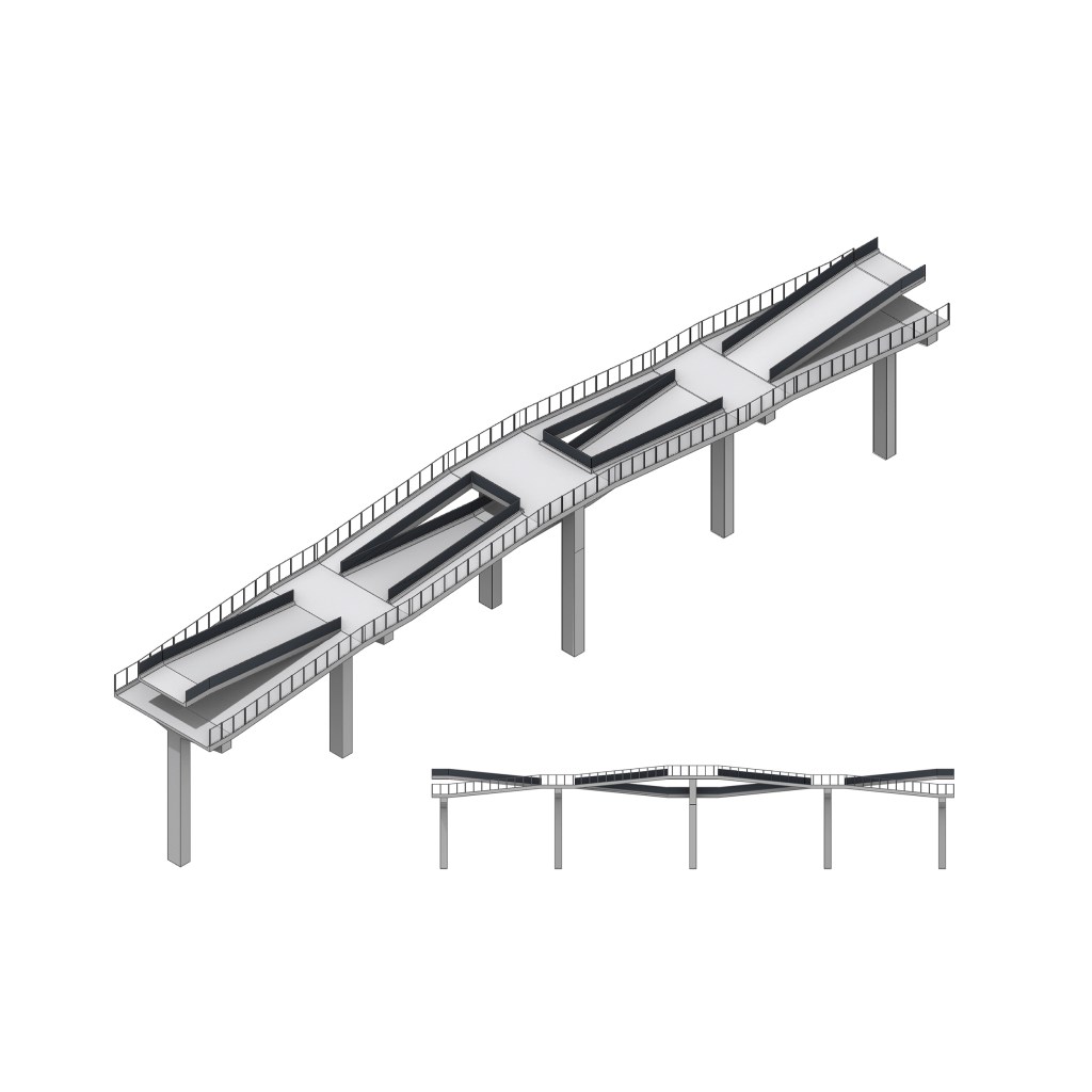
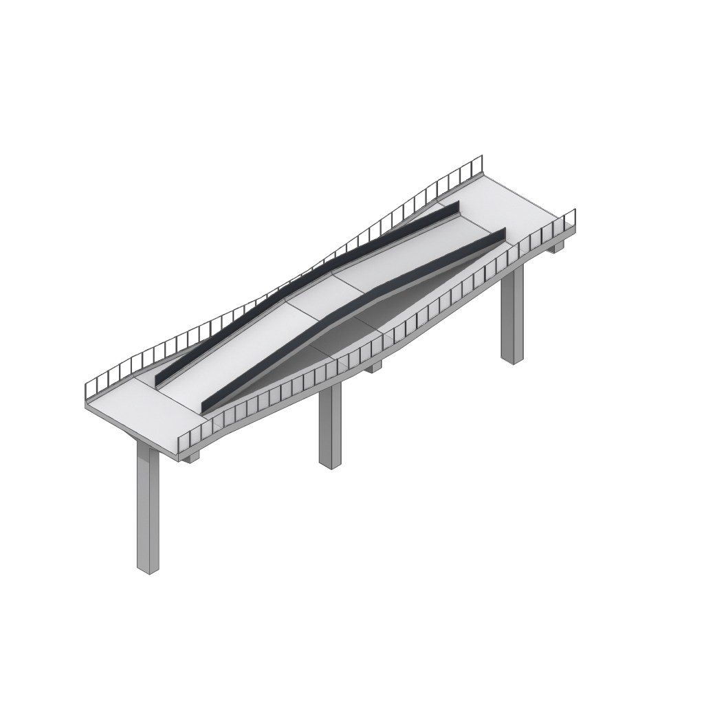
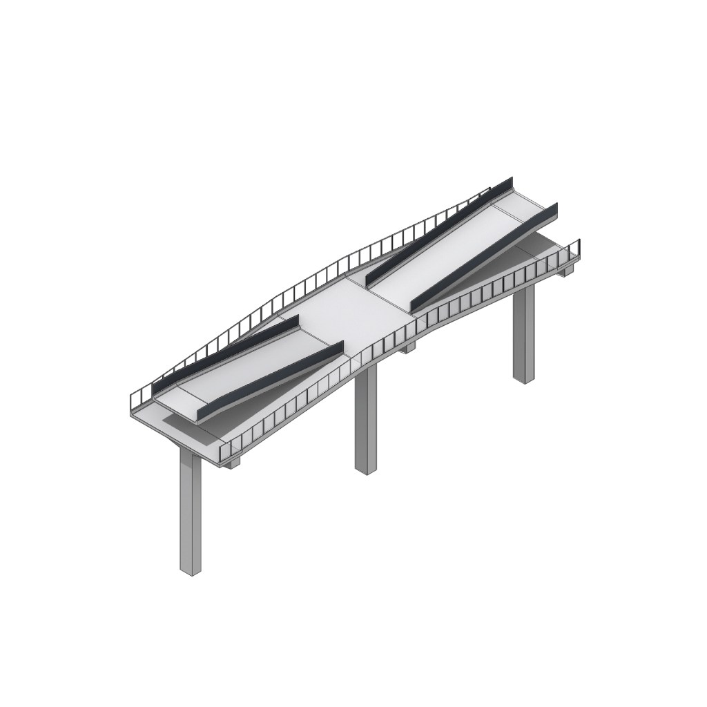
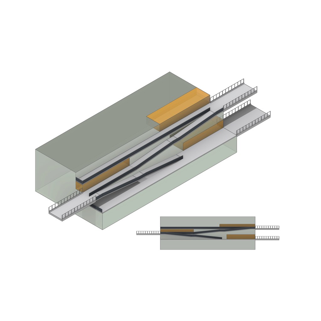
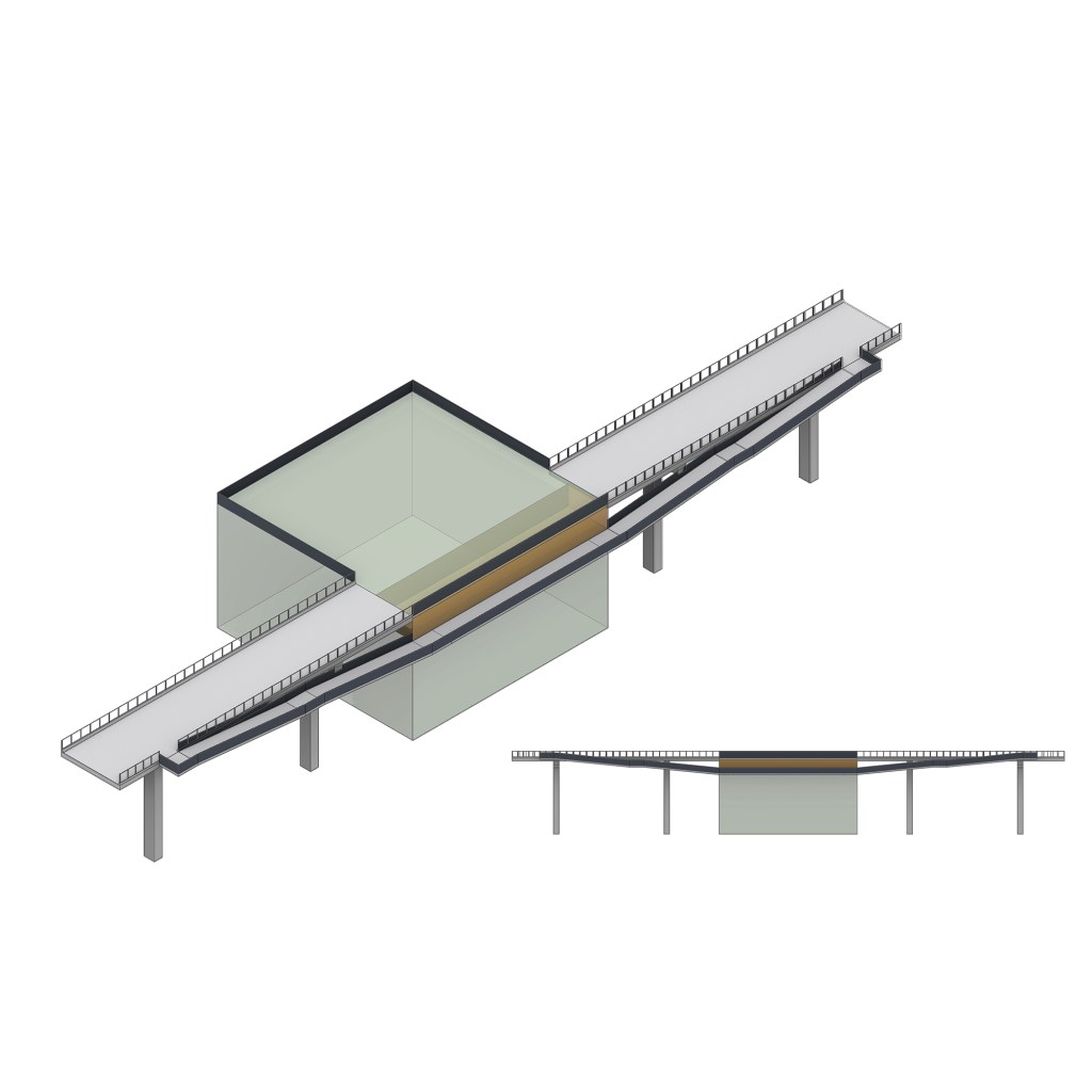
Bridge Type
Most of the bridges will be fixed at a certain height, but we’ll add more ramps to connect to other parts of the building, depending on its elevation. So my first bridge is a big horizontal deck with a ramp going up and down. And the second one extends from it by replacing the deck with another ramp, which makes it look like a wave, and supplies users a different experience. The third bridge tries to increase the opening between the two Ramps of the second bridge. So that additional Bridges can cross it. The following Bridges are the simplified version of the large bridges above.


Rendering


Model